The Wallasea Island Site Visit
Please click here for a fuller PDF version of this blog
Wallasea Island was the site visited by our group of MA students on a beautiful sunny day last week. We’d been thinking about where best to go in the Thames estuary area to see in action some of the themes discussed in our environmental history course (Environmental History and the Sea: The British Isles, 1800 to 2013, part of the MA in Maritime History, at the Greenwich Maritime Institute). Wallasea was suggested by one of our students and turned out to be perfect. Political debates over port development, erosion and flooding, leisure and the coast: they’re all at Wallasea. It is here that the Royal Society for the Protection of Birds (RSPB) is developing its Wild Coast project: the largest ‘habitat creation’ scheme in Europe.
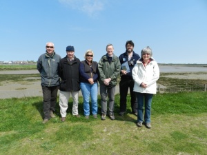
We were very fortunate to have the opportunity to meet up with the RSPB’s Wallasea Island Project Manager, Chris Tyas. He showed us the site and talked to us about the project’s three main inter-locking strands: Defra’s ‘Wallasea Wetlands Creation Project’, the RSPB’s Wild Coast Project, and the material provided by the Crossrail project.

© Vanessa Taylor, Greenwich Maritime Institute, 2013
Wallasea Wetlands Creation Project: Allfleet’s Marsh

© Vanessa Taylor, Greenwich Maritime Institute, 2013

© Vanessa Taylor, Greenwich Maritime Institute, 2013
These mudflats and salt marshes are part of a new site – Allfleet’s Marsh – created by Dept of the Environment, Fisheries and Rural Affairs (Defra) in 2005-06 for the Wallasea Wetlands Creation Project.
The project arose from a protracted political and legal dispute over port development and the preservation of coastal wetlands. Two East Coast areas earmarked for port expansion were excluded from designation as Special Protection Areas (SPAs) on the grounds of their socio-economic importance. (The areas were: parts of the Lappel Bank on the Medway, developed by the Port of Sheerness, and Fagbury Flats in the Orwell estuary, developed by the Port of Felixstowe). The conservationist case was argued by the RSPB. They took it to the European Court of Justice, who in 1996 decided that socio-economic importance was not a valid reason for exclusion from designation as an SPA under EU legislation (the Birds and Habitats Directives). This was confirmed in a legal ruling of the House of Lords in 1997. Retrospective action was taken by the government to create a new coastal wetland habitat in compensation, elsewhere within the Greater Thames Estuary Natural Area. Wallasea Island was ultimately chosen as the new site.
Defra worked with the Environment Agency, English Nature (now Natural England) and RSPB on the project. Breaches were made in the old sea wall and the sea now pours twice a day into this area of 284 acres (115 hectares), up to the new sea wall. ABP mer (Associated British Ports Marine Environmental Research) have been responsible for the environmental monitoring of the project. The RSPB manage the site.
There is still debate about the efficacy of habitat compensation sites. Can newly created habitats adequately compensate for long-established habitats, now lost? A good place to start for academic research on intertidal habitat creation is the work of Alastair Grant, Hannah Mossman and others at the University of East Anglia. See: ‘Restoration and Creation of Saltmarshes and Other Intertidal Habitats’ at http://www.uea.ac.uk/~e130/Saltmarsh.htm.
Wallasea Island and the RSPB’s Wild Coast Project
Wallasea Island is part of what is sometimes called the ‘Essex Archipelago’: the network of islands created by rivers and estuaries that flow into the North Sea, including Havengore, Potton Island, Foulness, Canvey Island and others. Wallasea itself is located between the Crouch estuary to the north and the Roach estuary to the south.
According to an RSPB article, Wallasea was once five distinct saltmarsh ‘islands’, used by farmers for grazing. The area was converted to arable land in the inter-war years, with the building of sea defences and land drainage. It was hit badly by the 1953 flood and has since relied on sea walls for protection.
The RSPB’s current Wild Coast Project expands this Defra scheme, developing the largest ‘habitat creation’ site in Europe. Almost 1,500 acres (607 hectares) of salt marsh, mudflats, saline lagoons and freshwater areas are being created to provide a diversity of habitats. The land behind the existing sea wall currently lies around two meters below sea level. So the level of the land needs to be raised before further development. This is where the earth dug up by Crossrail comes in (see below). In due course, the existing sea wall will be removed and new sea defences built further back as part of the process of ‘managed realignment’. The project is due for completion in 2020 and will be managed by the RSPB.
Plant life is already becoming established on Defra’s mudflats: the evocatively named glasswort (now sold in shops as marsh samphire), sea purslane, common saltmarsh grass, and clumps of Spartina Anglica. Like many non-native species now found in Britain, the Spartina family is part of our maritime legacy. It’s thought to have first arrived in the nineteenth century in the ballast water of ships docking at Southampton Water. There is also English scurvy-grass here, at one time eaten by those at sea to ward off scurvy.
None of us in the group were committed bird watchers but it is impossible to visit an RSPB reserve and not be seduced by the birdlife. There were linnets flying up from the grassy sea wall as we walked along it. We saw whimbrels and little egrets, and undoubtedly missed many more. The island though won’t really come into its own as a haven for birds until site construction is over.
A visit to Wallasea Island shows that there is much more to the Essex coast for visitors than the seaside resorts of Southend and Clacton-on-Sea. Places like Wallasea, Northey Island (run by the National Trust) and Abbotts Hall Farm (Essex Wildlife Trust) are part of a new kind of coastal tourism. Here, habitat restoration is at the heart of the tourist attraction.
For more on the East Coast see, for example, Jules Pretty’s coastal journey round Essex, Suffolk and Norfolk in This Luminous Coast (Full Circle Editions, 2011). For something shorter, this is his article: ‘Discover Wild Essex’ at http://www.countryfile.com/countryside/discover-wild-essex.
The Crossrail Connection
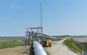
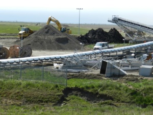
Crossrail is the Transport for London subsidiary currently working on a major new rail route being constructed under London. As part of its environmental remit, millions of tonnes of earth from the tunnelling are being conveyed by ship to Wallasea Island.
Mostly London Clay, sand and gravels, this material will be shipped up to five times a day when at maximum capacity, from Northfleet, Barking Riverside and Instone Wharf on the Thames. The material will form the base for the first phase of the island’s new landscape. Shipments have begun, with vessels from the Hav fleet. Both the Port of London Authority and Crouch Harbour Authority have piloting responsibilities for the shipping. This project is partly a response to long-standing demands for better use of the River Thames as a highway for freight transport.


Wallasea and Witches
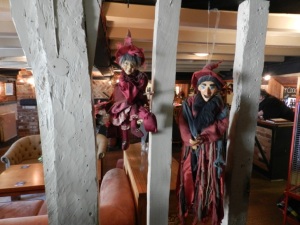
For lunch we went to The Anchor pub in the village of Canewdon near the western entrance to Wallasea Island. Canewdon has a long association with witchcraft and the punishment of witches. It still has a reputation as one of the most haunted places in the UK. Halloween, according to the pub landlord, is their busiest night of the year. The pub is decorated for Halloween all year round.

© Vanessa Taylor, Greenwich Maritime Institute, 2013
Environmental History and the Sea: The MA Option
Environmental History and the Sea: The British Isles, 1800 to 2013 is an option on the MA in Maritime History at the Greenwich Maritime Institute (a specialist post-graduate institute within the University of Greenwich.)
Sessions include: Coastal Environment and Planning Port Development and the Environment Coastal Erosion and Flooding Fisheries, Habitats and the Marine Environment Offshore Oil and Gas Land-Based Pollution and the Sea Shipping Industry and the Environment Estuaries: Thames as a Case Study Leisure and the Sea Marine Environmental History (Concepts and Sources) Marine Environment and the Future.

© Vanessa Taylor, GMI, 2013
How to get to Wallasea Island
You can get to Wallasea Island: by train to Rochford (then taxi – not the cheapest option, as I found) on the Liverpool Street to Southend line; by car; or at weekends and bank holidays in the summer by ferry from Burnham-on-Crouch, on the north bank of the River Crouch. The Visit Essex and RSPB Wallasea Island Wild Coast websites have details.
Dr Vanessa Taylor
___________________________
Dr Vanessa Taylor is Course Tutor on the ‘Environmental History and the Sea: The British Isles, 1800 to 2013’ option. A GMI Research Fellow, Vanessa is also part of the team on the current GMI research project ‘Running the River Thames: London, Stakeholders and the Environmental Governance of the River Thames, 1960-2010’.